
The American Surveyor series (1966-1978) comprised of seven missions to the moon with a primary purpose of identifying
potential landing sites for the upcoming Apollo manned missions. Two of the seven Surveyor probes crashed and/or lost
contact (Surveyor 2 and 4) whereas the remaining five managed to not only soft-land on the moon but take a large
number of photos and perform soil analysis. As indicated by the coordinates below, four of the five Surveyor probes that
did land successfully did so in maria around the lunar equator. For additional interesting details regarding each of
these missions, click here.
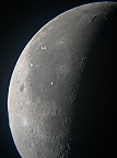
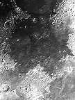
Click on any image for a larger rendition with imaging details.
| Surveyor Landing Sites | ||||||
|---|---|---|---|---|---|---|
 Surveyor 1 May 30, 1966 Flamsteed P 2.45ーS, 316.79ーE |
Surveyor 2 Sep 20, 1966 Copernicus Crater (Crashed!) |
 Surveyor 3 Apr 17, 1967 Oceanus Procellarum 2.94ーS, 336.66ーE |
Surveyor 4 Jul 14, 1967 Sinus Medii (Crashed!) |
 Surveyor 5 Sep 08, 1967 Mare Tranquillitatis 1.41ーN, 23.18ーE |
 Surveyor 6 Nov 07, 1967 Sinus Medii 0.46ーN, 358.63ーE |
Surveyor 7 Jan 07, 1968 Tycho Crater 41.01ーS, 348.59ーE |