
The third body from the Sun we commonly refer to as "Home Sweet Home" is certainly the most unique planetary body as
evidenced by the sole existence of life within our solar system and possibly within the universe. Being at the "right"
distance from our sun, a G2-type star approximately half-way through its 10-billion year life span, this planet has the
both the key elements and in the proper combinations thereof to permit for life, as we know it, to not only exist and
flourish but be characterized with a wide spectrum in its form, structure and behaviour and in spite of the fact its
building blocks are predominantly based on three atomic elements (carbon, hydrogen and oxygen).
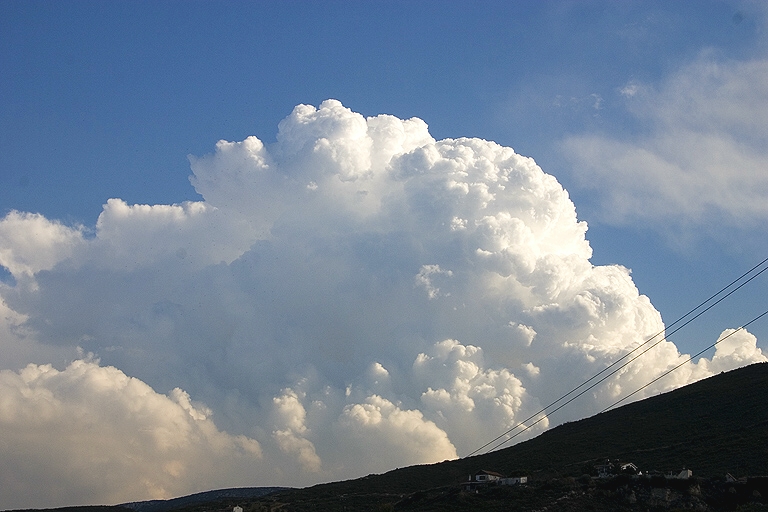
Clouds are one of the most dominant features which characterize our planet, for they blanket a good portion of the
planet each and every day. These formations represent water in various states (solid: snow or ice crystals, liquid:
water, gaseous: vapour) and are generally categorized into one of three types based on their altitude and one of
four types based on pattern. For the former where classification is based on altitude, we have "strato" for cloud
bases between the ground and 6,500 feet altitude; "alto" for cloud bases between 6,500 and 20,000 feet; and "cirro"
for cloud bases at 20,000 feet or higher. For the latter classification, clouds are categorized on the basis of their
formation and include "cumulus" (heaps of clouds); "stratus" (layered clouds); "cirrus" (curled clouds); and "nimbus"
(rain clouds). Using these two sets of classifications simultaneously, we are led to such common terms, for example,
as "cirrostratus" (layered clouds above 20,000 feet), "altocumulus" (cloud heaps between 6,500 and 20,000 feet) and
"stratonimbus" (rain clouds below 6,500 feet in altitude). Some special cloud formations with widely-recognized terms
include "fog" where a cloud is in contact with the ground and "contrails" where vapour from jet engine exhausts
crystallizes into ice particles due to the high-altitude of the airplane and associated cold temperatures.
For an excellent discussion on clouds with a rich supply of photos, see the Plymouth State University
Meteorology Program and/or Harold Edens' Weather
Photography website.
Note: When cumulus clouds manage to push a layer of moist air upwards leading to
condensation and a capping of the underlying cumulus layer, we have a Pileus Cap as illustrated by the example below.
 |