
Roughly 500 geostationary satellites are currently placed in a static orbit (as viewed by a ground-based observer) about our planet at an
altitude ranging from 500 to 40,000 kilometers. The closest satellites orbitting the planet are believed to be spy satellites whereas most
distant are the geostationary group of satellites with an instrinsic magnitude of 11 or greater. As a result, due to their distance and faint
magnitude, geosats may be classified as the DSO's of the satellite world. At their high altitude not only can they virtually view the complete
globe below them but they also have the unique characteristic of having their orbital speed closely match the rotational speed of the earth
and, as such, give the impression to a ground-based observer of being stationary above the planet. These satellites have a wide range of
applications and functions and include remote sensing (Meteosat, GOES-East and GOES-West, GMS etc) and such telecommunication functions as
direct broadcast voice and video communications as well as live television coverage (Astra, Hot Bird, Telstar etc) by virtue of the fact they
can beam their signal from a "fixed" point in space relative to a ground source.
Note: Arabsat 5A was launched from Kourou, French Guiana using an Ariane 5 ECA rocket on June 26, 2010, weighs
4.839 tons and features 26 C-band and 24 Ku-band transponders with an expected lifetime of 15 years. Arabsat 5A has a footprint which covers
the Middle East, North Africa and sub-Saharan Africa with broadcast transmissions related to television, telephone and business communications,
Internet and various other interactive services.
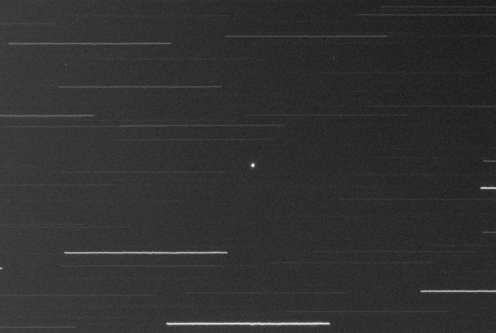
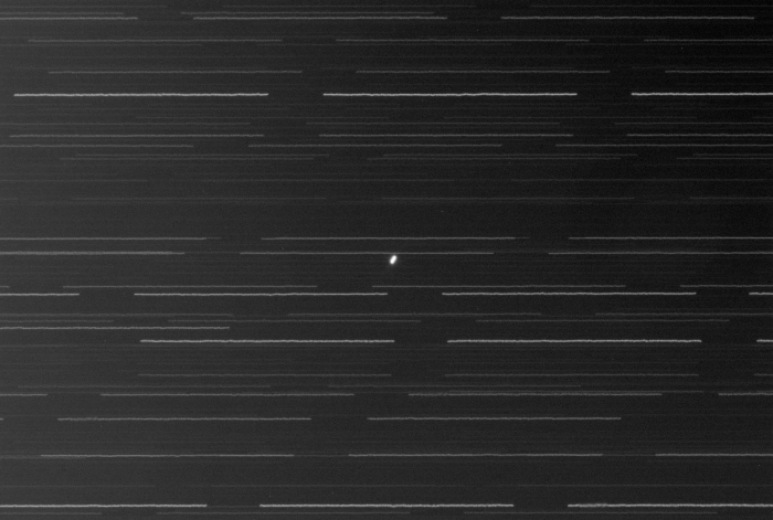
Note: The first image below represents a single one-minute exposure whereas the second image below is the sum of
the fifteen one-minute exposures captured and which reveals some very slight motion for the four Astra satellites during the approximate 20-minute
span and which quite often is characteristic of geosats (ex. due to inclination).
|
NORAD ID: 36745 Common Name(s): Arabsat 5A, BADR 5A Int Code: 2010-032B Location: 30.5° East Perigee: 35,779.4 km Apogee: 35,807.6 km Inclination: 0.1° Period: 1,436.0 min Launch Dates: Jun 26, 2010 Origin: Arab Satellite Communications Organization |
|
Date: Nov 02, 2012 21:22 - 21:40 UT+2 Location: Athens, Greece Equipment: AP 305/f3.8 Riccardi-Honders AP 1200GTO GEM SBIG ST-10XME SBIG CFW10 SBIG LRGB filters Integrations:
Image Scale: 1.21" per pixel Temperatures:
Software: CCDSoft V5.00.201 CCDStack V1.6.0.5 Photoshop CS5 |