
Roughly 500 geostationary satellites are currently placed in a static orbit (as viewed by a ground-based observer) about our planet at an
altitude ranging from 500 to 40,000 kilometers. The closest satellites orbitting the planet are believed to be spy satellites whereas most
distant are the geostationary group of satellites with an instrinsic magnitude of 11 or greater. As a result, due to their distance and faint
magnitude, geosats may be classified as the DSO's of the satellite world. At their high altitude not only can they virtually view the complete
globe below them but they also have the unique characteristic of having their orbital speed closely match the rotational speed of the earth
and, as such, give the impression to a ground-based observer of being stationary above the planet. These satellites have a wide range of
applications and functions and include remote sensing (Meteosat, GOES-East and GOES-West, GMS etc) and such telecommunication functions as
direct broadcast voice and video communications as well as live television coverage (Astra, Hot Bird, Telstar etc) by virtue of the fact they
can beam their signal from a "fixed" point in space relative to a ground source.
Note: TurkSat 2A was launched from Kourou, French Guiana using an Ariane 44P rocket on January 10, 2001 and its
purpose is DTH (direct to home) voice, video and data transmissions. It weighs 3.535 tons and broadcasts between central Europe and the Indian
continent using 32 Ku-band transponders. TurkSat 3A also launched from Kourou, French Guiana using an Ariane 5 ECA rocket on June 12, 2008 and
its purpose is telecommunications and direct TV broadcast services. It weighs 3.07 tons and broadcasts throughout Europe, Turkey and Central
Asia using 24 Ku-band transponders.
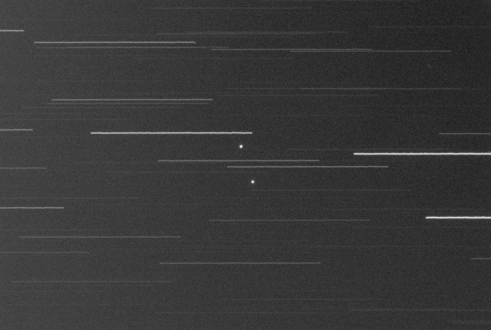
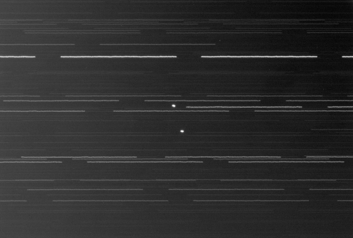
Note: The first image below represents a single one-minute exposure whereas the second image below is the sum of
the fifteen one-minute exposures captured and which reveals some very slight motion for both TurkSat 2A and 3A during the approximate 20-minute
span and which quite often is characteristic of geosats (ex. due to inclination).
|
NORAD ID: 26666 (2A), 33056 (3A) Common Name(s): TurkSat 2A, TurkSat 3A Int Code: 2001-002A, 2008-030B Location: 42.0° East Perigee: 35,768.5 - 35,776.4 km Apogee: 35,808.7 - 35,818.9 km Inclination: 0.0° Period: 1,436.1 min Launch Dates: 2001-01-10 (2A), 2008-06-12 (3A) Origin: Turkey |
|
Date: Nov 02, 2012 21:01 - 21:20 UT+2 Location: Athens, Greece Equipment: AP 305/f3.8 Riccardi-Honders AP 1200GTO GEM SBIG ST-10XME SBIG CFW10 SBIG LRGB filters Integrations:
Image Scale: 1.21" per pixel Temperatures:
Software: CCDSoft V5.00.201 CCDStack V1.6.0.5 Photoshop CS5 |